

A chronicle of trials, tribulations and triumphs aboard Tatoosh!
Monday, July 14, 2014


July 14 - Beaver Harbour
We made it through the fog, again. We had a few boats identified [by radar] and not seen until the very last minute; all a bit tense but no real danger.
A kindly water taxi operator came over and hailed us; saw the crew on bow watch and thought we didn't have radar and offered to escort us to wherever we were going. We explained we had working radar ( didn't explain that the skipper was an over cautious engineer) and thanked him... and he was off into the fog.
We are anchored in lee of an island , in Beaver Harbour, that will keep the worst of the forecast strong NW winds away from us. Our position is N50 deg 43.43 minutes/W127 deg 23.9 minutes if you want to see it on Google maps or Google Earth.
The canned stores are being depleted as we munch our way through them. We have plenty of cold cuts,etc for sandwiches but main meal protein is now limited to canned meat ( either ham or chicken).
The fog bank we traveled through is visible in the background of the photo of our anchorage.
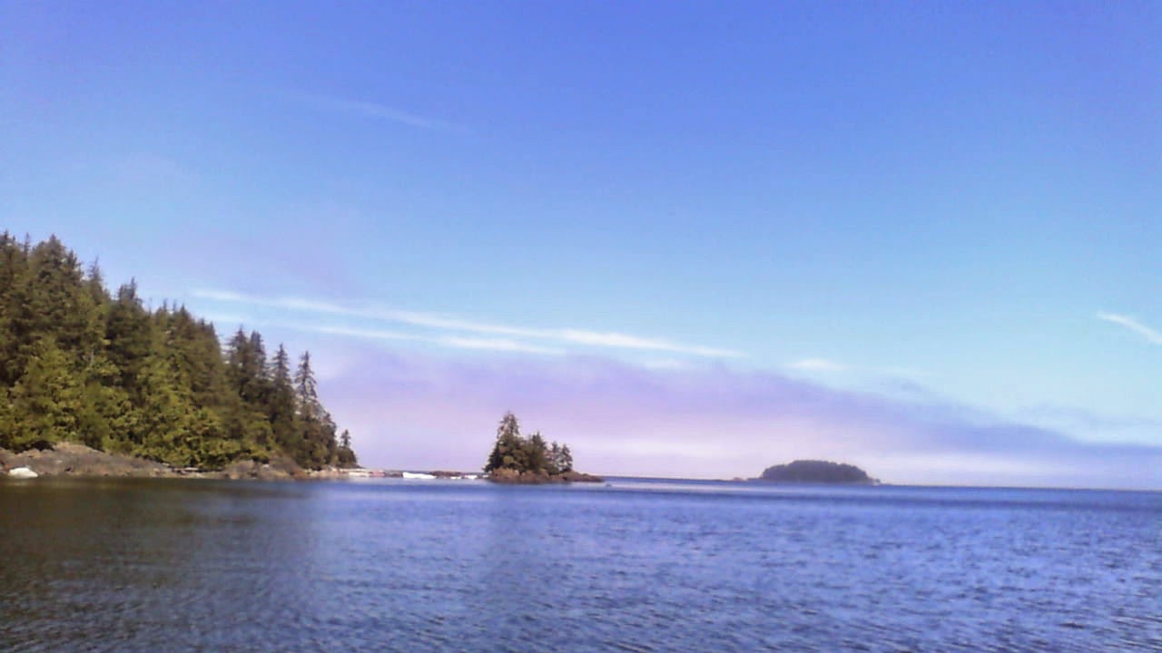 The current plan is to head towards Telegraph Cove and then we are positioned to make our 2 day run Johnstone straight when the weather is suitable. At the moment, the forecast-ed high winds don't hit until late afternoon, so it may be a case of doing what we did on the way up: get away early . The upside is that the winds, if they do spring up , will be at our back, rather than having to beat into them.
We should be in cell phone range until we start down Johnstone straight.
A kindly water taxi operator came over and hailed us; saw the crew on bow watch and thought we didn't have radar and offered to escort us to wherever we were going. We explained we had working radar ( didn't explain that the skipper was an over cautious engineer) and thanked him... and he was off into the fog.
We are anchored in lee of an island , in Beaver Harbour, that will keep the worst of the forecast strong NW winds away from us. Our position is N50 deg 43.43 minutes/W127 deg 23.9 minutes if you want to see it on Google maps or Google Earth.
The canned stores are being depleted as we munch our way through them. We have plenty of cold cuts,etc for sandwiches but main meal protein is now limited to canned meat ( either ham or chicken).
The fog bank we traveled through is visible in the background of the photo of our anchorage.
We should be in cell phone range until we start down Johnstone straight.
July 13 - bull harbour
Once again we were in fog with close to 0 visibility. The fog lifted part way but the entrance to bull harbour was socked in and we gingerly made our way in to tie up at the First Nations dock. Without radar and the chart plotter we would not have gone anywhere.
We had a good walk on the beach at Roller Bay; most of the beach is made up of large pebbles which you hear rattling away as the waves come in/out. Near Nootka there is a similar beach that the natives called "singing beach'.
We came across a beached ocean survey bouy ( which I still need to report..the sticker says the company is in Nova scotia, but I will be amazed if the buoy was launched in Nova Scotia and made it here!
There were also either dog/wolf/cougar tracks and scat on the beach. Dog was eliminated because there seems to be no dogs in the living area, the prints have no claws and the scat is not from a domestic dog. So it is either a wolf or cougar.
Tomorrow we start back and are aiming for Beaver Harbour just below Hardy Bay [ Port Hardy]. This harbour is where the HBC once had a fort where they shipped coal for their fleet of boats.
Update on meals:
tonight we had 'ham hash':; canned ham, onions,garlic,spices,corn,red pepper,mushrooms and mashed potatoes with augmented left-over salad from yesterday. Dessert was upside-down black cherry cake with cherry sauce and yogurt.


We had a good walk on the beach at Roller Bay; most of the beach is made up of large pebbles which you hear rattling away as the waves come in/out. Near Nootka there is a similar beach that the natives called "singing beach'.
We came across a beached ocean survey bouy ( which I still need to report..the sticker says the company is in Nova scotia, but I will be amazed if the buoy was launched in Nova Scotia and made it here!
There were also either dog/wolf/cougar tracks and scat on the beach. Dog was eliminated because there seems to be no dogs in the living area, the prints have no claws and the scat is not from a domestic dog. So it is either a wolf or cougar.
Tomorrow we start back and are aiming for Beaver Harbour just below Hardy Bay [ Port Hardy]. This harbour is where the HBC once had a fort where they shipped coal for their fleet of boats.
Update on meals:
tonight we had 'ham hash':; canned ham, onions,garlic,spices,corn,red pepper,mushrooms and mashed potatoes with augmented left-over salad from yesterday. Dessert was upside-down black cherry cake with cherry sauce and yogurt.
Juy 12 Update
We made it into God's Pocket in the afternoon, but motored all the way as there was little wind until late in the afternoon.
I am not sure why there is all of the hype around god's pocket; it is a tiny, narrow anchorage and if there had been another boat, we'd have had to move. However, it is protected.
To make matter's worse, we are here on a Spring tide, which means the low water is close to "zero" meaning it doesn't get any lower!
 Tomorrow will be a short trip to Bull Harbour on Hope Island; our furthest north anchorage before we start the return leg.
I am not sure why there is all of the hype around god's pocket; it is a tiny, narrow anchorage and if there had been another boat, we'd have had to move. However, it is protected.
To make matter's worse, we are here on a Spring tide, which means the low water is close to "zero" meaning it doesn't get any lower!
Update

Saturday, July 12, 2014
July 12-morning

We are hoping it clears soon with some sun and wind as forecast.
--
Regards,
Bruce Warren P. Eng
Bruce Warren P. Eng
Subscribe to:
Posts (Atom)